
Madison County, IN
Cemetery Information by Township:
Many of these links will refer you to the pages of the Madison County Cemetery Commission website that has lots of fantastic information.
UNION TOWNSHIP [Chesterfield]:
Click on the cemetery below to see a list of pioneer burials, history, bits of biographies, and pictures.
CREDIT to the Madison County Cemetery Commission for the following interactive map!
Click on any cemetery name on the map below to see a history, a list of pioneer burials, bits of biographies, and pictures.
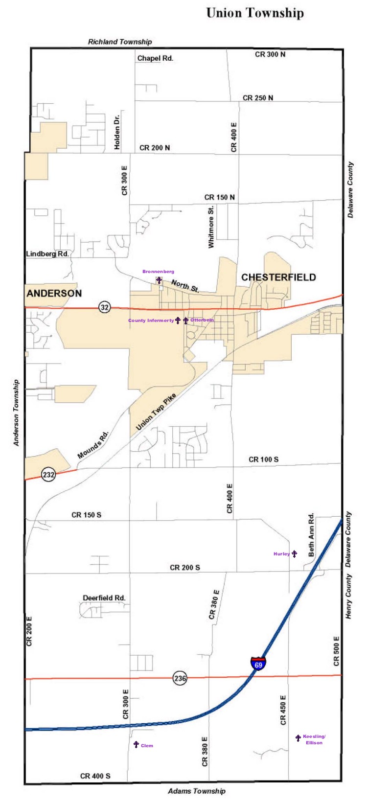
Pioneer Cemeteries:
N side of North St., end of Skyview Dr. in Chesterfield /GPS N40.06.795; W085.36.392
---------------------------------
E side of CR 300E, between I69 & CR 400S /GPS N40.03.320; W085.36.601
---------------------------------
County Infirmirary-Potter's Field-Poor Farm (no markers)
N side of 10th St., between Anderson City Airport and Otterbein Cemetery/ GPS N40.06.699; W085.36.613
---------------------------------
E of CR 450E, N of 200S (on Petrel Wood farm) /GPS approx.N40.03.315; W085.36.592
---------------------------------
Keesling-Ellison-New Keesling-Cummins
E side of CR 450E, between SR 236 & CR 400S /GPS N40.03.240; W085.35.171
---------------------------------
Old Bronnenberg (inside of Mounds State Park)
Unmarked and located somewhere inside the west end of the park.
---------------------------------
Otterbein-Makepeace-Chesterfield-United Brethen
N. side of 10th St., between Anderson City Airport and Linden Lane in Chesterfield/ GPS N40.06.204; W085.36.510
---------------------------------
Other Cemeteries:
Camp Chesterfield Memorial Gardens
50 Lincoln Drive Chesterfield, Madison County, Indiana, 46017